Part 5: Garmin zūmo 660 Settings
The other sections of this multi-part review of the Garmin zūmo 660 includes further insight into the tools provided by the 660.
Part 6 (Next) also identifies some basic differences between the 550 and the 660.
Also, it lists some compatible Bluetooth systems and provides the Bottom Line scoop on the newest addition to the zūmo line.
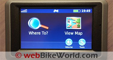
The following section provides further insight into the individual tool categories.
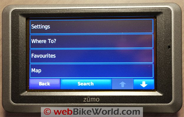
Settings
This is probably the first or second stop for new users. This sub-category lets the user begin to customize the device by changing system, navigation, display, time and language settings.
Settings – Maps
Map Settings are also accessed from this point via the map detail, view, vehicle, trip log, map info and restore options.
Settings – Security
While hard-mount physical security options might be limited, the zūmo 660 provides two security settings that will help protect user data.
Garmin Lock allows a four digit PIN to be created and stored in a security location, and Safe Mode, unless turned off, disables all functions requiring “significant” operator attention that could be distractions while in motion.
Restore will put security settings back to original values, except for the PIN or its location.
Settings – Traffic
FM Traffic Message Channel (TMC) subscription information is accessed via “Tools – Settings – Traffic” and the information displayed will be based on the identified locale during initial setup.
This feature allows Traffic Information mode to be turned on or off, the Provider selected, search for additional TMC providers and finally, Subscription.
The zūmo 660 receives FM Traffic Message Channel or MSN Direct content depending on which (traffic) receiver is used and which subscription is purchased. I haven’t yet activated either service yet.
But I have used the TMC service as provided with the Garmin 265WT and it proved to be a useful feature when traveling in and through urban areas that provide the service, especially along the I-81 and I-95 corridors.
The Garmin website identifies that the Premium Traffic Subscription service for North America and other parts of the world is provided by Clear Channel, whereas other pages identify other providers for North America?
Settings – Proximity Points
The Proximity Point Settings feature is a valuable tool that requires some interaction by the user and/or the downloading of specific data, such as custom POIs, safety camera databases or a TourGuide™ file.
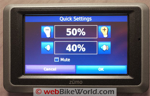
Tools – Settings – System
GPS Simulator turns off GPS mode and simulates navigation, in real time and using archive/average movement data to provide a realistic environment.
Usage modes are: motorcycle, scooter, automobile and pedestrian. Simulation mode is very power efficient as well.
Units of measurement can be changed between metric (km) or English (mi).
The keyboard layout options are QWERTY, ABCDE and Large Mode.
The final selection is “About” which displays the software version number, unit ID and the audio version for the unit. All of this is useful when maintaining a functional baseline or when purchasing additional software.
Tools – Settings – Navigation
From here you can select the desired preference to calculating a route – faster time, shorter distance and off-road, my personal favourite.
The only thing to remember here is that the system will sometimes calculate a Line-of-Sight routing that could be hard to achieve, at least without flight capabilities…
Tools – Where Am I
While not a totally new feature, the “Where Am I?” tool in its latest presentation form is very easy to use and encapsulates information so necessary in emergency situations, especially where immediate assistance if needed and when first responders may be involved.
Tools – Help
This is a pretty impressive feature that can prove to be an essential tool in some circumstances.
Users are presented with a category listing, or the “Search” menu can be invoked. Either way, it is a great tool.
Tools – Media Player
The Media Player provides high quality stereo audio via two 3.5mm outputs, one on the chassis and another on the integrated harness, or via the Bluetooth A2DP (stereo) capability.
The updated media player supports MP3 music files and M3U and M3U8 playlist files allowing playlists created on the zūmo or downloaded from a computer to be used.
A continued feature sure to be appreciated by many is the ability of the Media Player to play compatible Audible Books available from a number of sources.
A bookmark can be created for any file as well allowing a session to be resumed easily.
Another thing I really like – the shortcut icons that show up on the right side of the screen when the Media Player and/or Phone applications are active.
A musical-note icon represents the Media Player while a “P” icon indicates when a mobile phone is paired with and hosted by the GPS.
Tools – MSN Direct
Although a heavily touted feature, according to the Garmin website, the MSN Direct service will only be available until 1 January 2012 or for just over two more years.
A subscription can still be made to receive the service and it seems that subscribers will get some additional free service time given the published expiry date.
Tools – Picture Viewer
Part of the Media Player bundle, the Picture Viewer let users view JPEG and JPG files stored in the 660 or removable media.
A slide show can be activated as well and stopped at any time by touching the screen.
Tools – Custom Routes
This tool is accessed from either “Where To” or “Tools”. The menu table basically walks you through the creation of a new custom route that can be saved off and retrieved for use or editing.
The options in editing a route are: change name (route), add or remove points, manually reorder points, optimally (automatically) reorder points, recalculate (by route preference – faster, shorter, off-road) and, delete. Changes are automatically saved upon exiting any route edit pages.
Tools – My Data
This tool manages “Set Home Location”, “Import Data”, “Manage Trip Logs” and “Delete Favourites”. To manage data – save, import and delete, this is the tool to use.
Routes from MapSource can be imported to the device by touching “Import Route from File”. If connected to a PC, the default settings will allow a quick and direct import of the file.
Tools – My Data – Manage Trip Logs
Management of Trip Logs, recorded during navigation, is done under the “My Data” tool. It is amazing how many users are not aware that this type of information is captured and stored.
This is unfortunate as the information stored can be invaluable in tracing or re-tracing a route, documenting a trip or activity and in providing an audit trail of sorts.

Trip logs can be saved (archived), retrieved for viewing, re-use or edited.
The service also allows any or all segments of a specific trip to be viewed, great for refreshing the memory or planning a re-ride over favourite ground.
When viewed, the archived trip log is presented as a distinctive coloured line on the map display. Other capture data, such as elevation, can be viewed, also by segment if desired.
Trip logs can be deleted by using the “Edit” and “Clear Log” selections. And finally, trip logs can be shared by simply using the “Share” and “Export” selections to save the trip log to the removable memory media.
Tools – World Clock
After not having this feature available on the 550, I can now check out current times for cities around the world by selecting a specific city. Selecting the “World Map” feature brings up a flat projection visual that depicts the time zones and the light to dark transitions based on the selected time zone.
Tools – Language Guide
The Language Guide is a personal favourite for “time well spent” breaks. It keeps the mental translator refreshed for those situations where a timely and correct phrase can mean everything.
The Garmin Language Guide provides five bilingual dictionaries — English, Spanish, German, French and Italian. The tool provides To/From look-up of Words and Phrases and bilingual dictionaries for the five languages.
When the tool is selected, an information screen will be presented which states that, “this is a sample version of the Garmin Language Guide and directs the user to visit the Garmin website.
Tools – Calculator
A simple tool, but always appreciated. After a long day on the road, the brain doesn’t always crunch as fast or as accurately as desired, so the calculator is a great verification tool.
Tools – Unit Converter
This tool converts: area, currency, distance, speed, temperature, volume and weight. Having worked in both a metric and English standards environment all my life, I don’t even think about most conversions any more, it just happens.
For referral purposes however, especially for other than speed, weight or measurement, this is another great tool to have directly at hand. Converting To/From is simple.
Tools – Unit Converter – Update Conversion Rates
Although part of the “Unit Converter” tool, this routine is interactive and allows the traveler to update currency conversion rates manually so that resultant currency calculations are based on current listings.
Tools – Offers
This is applicable only if the package includes a TMC traffic receiver.
If so, a variety of advertisements and coupons will be presented for your viewing and use as applicable. Just remember – do not, under any circumstances, try to access or write down while performing the critical task — maintaining control of the machine.
Garmin zūmo 660 Product Specifications
- Size – 136 x 83.4 x 24mm (5.35 x 3.28 x 0.94 in) W x H x D.
- Weight – 270g (6.17oz).
- Display – 4.3in diagonal touch-screen, 480 x 272 pixels, WQVGA TFT landscape display, white backlight.
- Case – Waterproof to IPx7 (immersion in one metre of water for 30 minutes).
- Operating Temperature – from -20C to 60C (-4F to 140F).
- Charging Temperature – from 0C to 45C (0F to 113F).
- Data Storage – internal memory is a nominal 4GB (actual available memory is based on system memory space requirements), removable micro-SD media (not included) allows storage space to be expanded. Data is stored indefinitely.
- Computer Interface – USB mass storage, plug n play.
- Headphone jack – Standard 3.5mm.
- Charge Time – Approximately four hours.
- Power Input – DC vehicle power using included automotive power cable and cradle, motorcycle mount with integrated DC harness. Power can also be supplied by optional USB charger or trickle-charged from compatible USB 2 ports.
- Usage – 10W max.
- Battery Life – three to seven (3 to 7) hours, depending on usage and settings.
- Battery Type – Removable lithium-ion battery, 3.5V, 1880mAh, 6.7Wh.
- GPS Receiver – High-sensitivity.
- Acquisition Times – Warm <1 sec, Cold <38 sec, Factory Reset <45 sec, times based on clear view of the sky.
| Garmin zūmo 660 Review: | |
| ▪ 1: Introduction to the the zūmo 660 | |
| ▪ 2: Physical Tour | |
| ▪ 3: Where To? | |
| ▪ 4: Using the zūmo 660 | |
| ▪ 5: zūmo 660 Specifications | |
| ▪ 6: zūmo 550 vs. 660 Comparison | |
| ▪ 7: Installation | |
| ▪ Owner Comments (On Page 1) | |