If it wasn’t for the ride-sharing and mountain and wriggly route options on our TomTom Rider 550 GPS we might never have discovered a hidden gem of a mountain road.
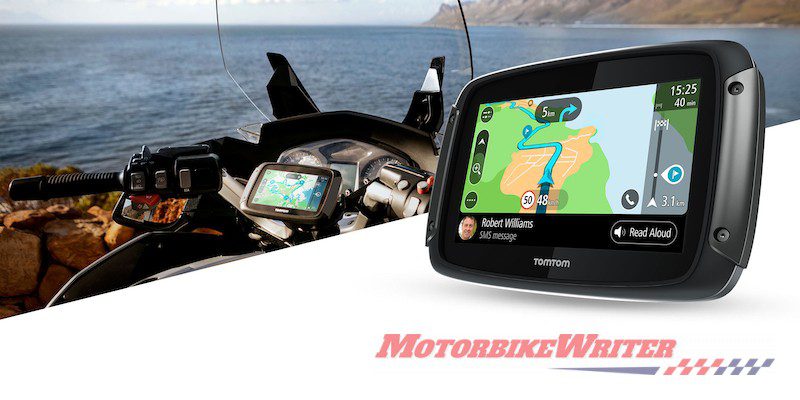
Riding partner and map expert Peter “Worldmapman” Davis recently reviewed the TomTom Rider 550 ($599) for us and has been using it now for some time.
Usually one of our riding group decides where to go and then leads the pack. It’s usually me and I’ve almost run out of routes in the South East Queensland area.
I think I know every twisting, winding scenic roads in this region. But I was wrong.
TomTom decides
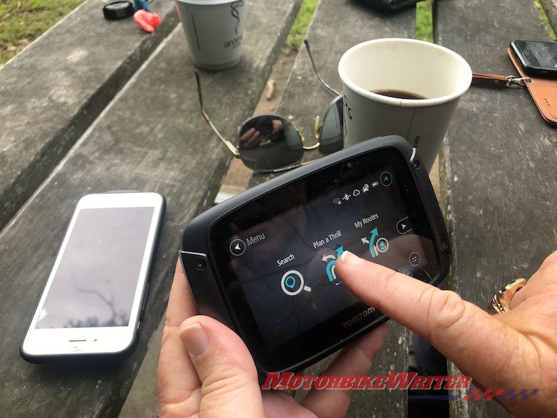 “Plan a thrill’ with TomTom Rider 550
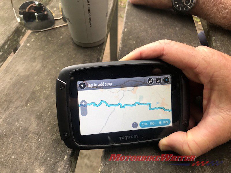
This time we decided to put the TomTom unit to the test and let it decide a route for us.
Since it was hot, we thought a ride up to Toowoomba at the top of the Great Dividing Range would give us a respite from the heat.
So we put that in as one waypoint, plus Hampton and Flagstone Creek.
You can select the waypoints by typing in a place name or simply pressing a point on the screen to drop a waypoint “flag”.
We then selected a return journey with maximum mountain and winding roads options. There are two levels of each and we chose the top levels.
That increased an out-and-back journey on the highway from about 160km to about 250km.
Because we were riding cruisers, we chose the “avoid dirt roads” option. You can also choose to avoid toll roads, highways and even roadworks in the settings menu.
Sharing a gem
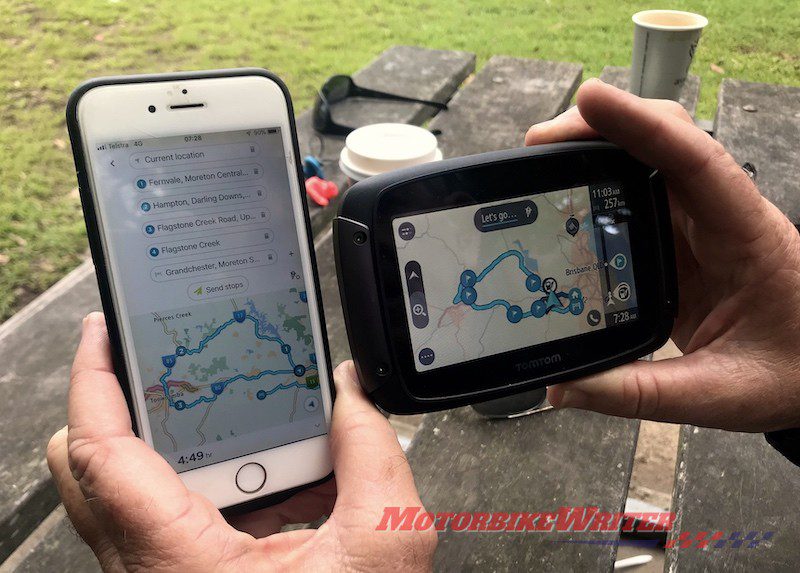 Sharing a route is easy
Route selected, we shared it among ourselves either with other TomTom GPS units or via their MyDrive app platform on their phones.
Sharing a route like this is great because it means you don’t have to bother about corner-man systems as riders can’t get lost.
You can plan your route on the GPS unit, or on the TomTom MyDrive app on your phone or your computer. Each allows you to share with other TomTom users via Bluetooth, email or message.
When we headed off on the Brisbane Valley Highway TomTom almost immediately took us off the highway on to back roads.
 TomTom will include scenic back roads
This led us the long way round to Esk before heading up the only sealed road to Hampton.
In fact, it even bypassed some of Esk.
Peter says a good tip in selecting waypoints on this sort of route is to never select a town’s CBD or the name of a town.
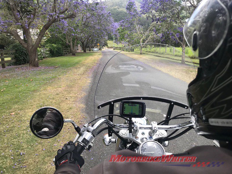
 Following the route
Always select a waypoint on a road past the town. That will actually throw in a nice little deviation and avoid sending you down every suburban street.
In fact, you should even start your journey out of town or it may take you on a wild goose chase around the suburbs first.
The great thing about the TomTom Rider 550 is that you can change your mind along the way.
If you decide to go into town for a coffee or toilet stop, just head on in and the unit recalculates the route very quickly.
In fact, it is the fastest of any unit Peter has used in his extensive mapping career.
You can also add more waypoints, or change the winding road option from super wriggly to less wiggly or to the fastest or most direct route if you are getting tired and want to head home.
 Wriggly route
All it takes is a touch of a button on the screen.
If you decide to bypass a waypoint, the unit will try to recalculate you back to it, so it’s a good idea to delete the waypoint by going to your list of stops and deleting it.
Gem discovered
We largely followed the directions, but also chose to ignore them a little and explore.
But we are glad we did not ignore its advice when we came down the Range on Flagstone Creek Rd.
It pointed left on to Blanchview Rd which we have done before and enjoyed, so we followed.
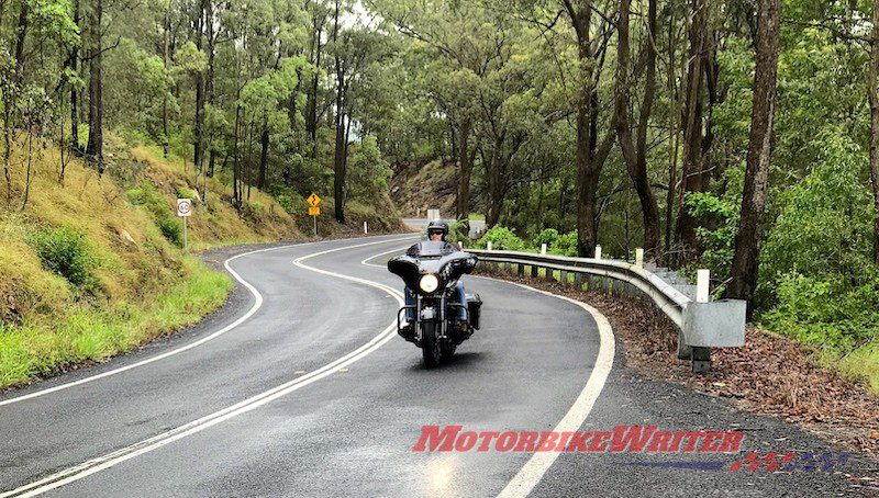
 Silver Pinch Rd is a gem
But shortly after TomTom took us right on to Silver Pinch Rd which looks almost like someone’s driveway. We’ve ignored this road in the past … but not today.
Just as well as it is a real rider’s gem.
It traverses several narrow ridges past Table Top Mountain, overlooking beautiful fertile farmland with jaw-dropping views on either side.
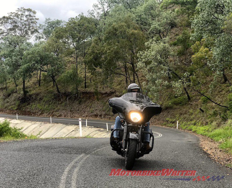
The road really does wriggle along and it seems it has only recently been paved along its entirety until it becomes Topps Rd and ends at the T junction with the Back Flagstone Creek Rd.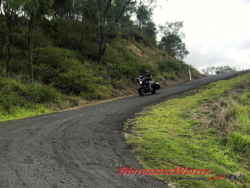
What a rollercoaster of a road it is with plenty of elevation, looping corners, esses and switchbacks.
We enjoyed it so much we stopped along the way for photos and doubled back a bit to ride some sections again.
Consequently we ended up running a little behind our schedule return time.
So at Laidley we simply decided to switch to the shortest destination and head home.
When we got home, we shared photos and maps with each other via MyDrive so we can do it again another time … maybe in a reverse direction.
You can do that by simply shuffling the order of the waypoints. Just drag and drop the last stop to the top and make the rest of the changes accordingly.